Lookout to Council, VA

Miles Today: 43.81
Average Speed: 8.5

Total Miles: 3,253.57

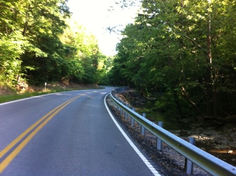
We awoke to fog again (I think this will be a regular occurrence), but it was a glorious morning. The rocks rose up on the side of the road, the air was cool in the shade and pleasantly warm in the sun, and we only got chased by 8 dogs.
20120518-113600.jpg
Evan has learned to spray dogs with his water bottle, which they don’t like. It usually buys us a little space to ride, if it doesn’t deter the dogs completely. We heard that Virginia doesn’t have so many mean dogs, so we were excited to get out.
We ran into Joe, who’s riding cross-country East to West.

20120518-113608.jpg
Joe has an awesome brim on his helmet, which is made in Michigan (the brim, not the helmet). Since I’m writing blog entries days after the actual riding, I absolutely cannot, for the life for me, remember what brand of brim he had.
While we were chatting, Kim and John rode up. It was a morning of friends!

20120518-113614.jpg
We warned them about the upcoming dogs, and they informed us about the glory that lies in Virginia, if we can get over the hills that separate us from it.
We diligently climbed, though, and surely enough, we finally reached something that appears to be a boundary.

20120518-113622.jpg
We crossed a big ol’ river, and then started the nasty climbs for the morning.
Breaks Interstate National Park consists of a series of steep hills in succession. Then, we get to be in Virginia.

20120518-113630.jpg
We stopped off for scenic overlooks, leaving the bikes far away climb up and down stairs leading us to the edges of cliffs.

20120518-113640.jpg
The view down into the river was a bit daunting. I was thankful for the tall railing.

20120518-113645.jpg

20120518-113659.jpg
As always, though, uphills mean downhills, so we climbed each time awaiting our payment.

20120518-113707.jpg
And then, up another hill, we found Virginia!

20120518-113718.jpg

20120518-113724.jpg
The heat has been pretty rough since the rain stopped falling, and by midday I find that I have prickly heat, or heat rash, or whatever kind of bumps these are.

20120518-113731.jpg
They don’t bother me, and I feel like they’re just sweat trapped under my suntan, so for now I’m trying not to be bothered by the texture of my arms.
We rode for a while, then stopped for more, umm…

20120518-113738.jpg
Photogenic Scenery? I thought that “scenic overlook” was sufficient. However, the scenery did make a nice picture.

20120518-113816.jpg
The flowers smelled like honey.

20120518-113822.jpg
And our big hill for the afternoon came complete with the triangle truck sign! My favorite thing after a long climb!

20120518-113829.jpg
When we got to the bottom, we were in the town of Haysi, where the woman at the gas station where we purchased overpriced gatorade informed us that to fill our water bottles from the water in the soda machine, we would be charged $1.19 for a refill. Per bottle. No, thank you! We headed down the street to the library, where Shirley the librarian let us fill up for free.

20120518-113835.jpg
We had a laugh about trying to charge so much for water, and she wished us well.
Evan is excited that we are momentarily riding on the Crooked Road, Virginia’s musical heritage trail. Unfortunately, we aren’t staying on it.

20120518-113843.jpg
We passed briefly through the town of Bee, but there wasn’t much there.

20120518-113853.jpg
Then, after stopping at a gas station for chocolate milk, we climbed some more hills until we were in Council, VA, home of a community rec center to rival all others. This place was huge, had at least three picnic shelter areas, a few playgrounds, wooden arks and trains and trucks and planes to climb in and on, and tons of grass.
We were lucky to come across Darla, a wonderful lady who was mountain biking up the hill in front of us. She showed us to the community center, then introduced us to her son, the lifeguard, who let us into the showers!

20120518-113859.jpg
They don’t look fancy, but hot water comes out of them! Really hot water! I felt so refreshed after that shower I could’ve done a dance.
Instead, we went and set up camp on a lush, grassy patch near picnic shelter #1, then met another cyclist, Bryan. Bryan, like everyone else, is headed west. He came and set up camp near us, and we enjoyed his company for the evening until bedtime. The sound of the creek running through the park lulled us straight to sleep.

Hazard to Lookout

Miles Today: 72.10
Average Speed: 9.5mph

Total Miles: 3,209.76

We woke up to fog, just like we have every morning that we weren’t waking to rain. The motel room was nice and warm, and we were thankful to have been indoors and, more importantly, to have used a clothes dryer, after our rainy rides the last few days.
After some oatmeal and coffee, we said goodbye to the Daniel Boone Motor Inn and got to getting out of Hazard.
20120518-102558.jpg
I later read that Hazard loosely associates its name with the Dukes of Hazzard, which may or may not have been based out of the county where Hazard is located. I bet it’s on Wikipedia, so if you’re interested to know, look it up and let me know what you find out.
We were amused by the towns coming up, though I wished they would’ve listed the towns in the other order for a more humorous reading.
20120518-112927.jpg
Unfortunately, we did not see any of Snow White’s counterparts when we reached Dwarf.
20120518-113023.jpg
We did see some signage that pleased us shortly outside Dwarf, though.
20120518-113032.jpg
Apparently, the state of Virginia has assigned the TransAmerica route an official number, and Perry County in Kentucky, the easternmost Kentucky county we passed through, has adopted the signage for it, too. This was the first bike route sign I’ve seen in, well, 3,200 miles. Talk about an exciting moment, and an even more exciting one when we realized that the rest of the route to Virginia is signed.
We passed through Hindman, where there’s a guy named Dave who puts bikers up for 25 bucks which includes premium tent camping, a glass of sweet mint iced tea, a loaded baked potato, brandy for those who take it, an ice cream sundae, laundry service overnight, and breakfast in the morning. We were just passing through, though, so we didn’t get to bask in the luxurious camping experience.
20120518-113100.jpg
After a decent climb on a four-laner with a good shoulder, we reached a fantastic place.
20120518-113115.jpg
Pippa Passes is plain old fun to say, and if you check the comments in previous entries, you’ll find a story on Pippa Passes from Mike Walton. I also read a story in another blog of some folks who cycled through, and left with a puppy, Pippa, who they discovered abandoned and hungry in Pippa Passes. I guess the pup just stays in their front pannier with its head out the top–the picture and story are both very heartwarming, and if I can find the blog where I saw it, I’ll link to it.
We saw a strip mall with a tank, whose significance I didn’t have the time to discover.
20120518-113109.jpg
We’ve been hearing murmurings of the reintroduction of elk to Kentucky for some time, but haven’t seen any sign of them. Finally, all we saw was a sign of them.
20120518-113125.jpg
We saw some cyclists shortly after, sporting nice jerseys and nice bikes.
20120518-113132.jpg
Lyle and Philip are from Australia, and are cycling for an organization called She’s My Sister, through the American Bible Association. You can check out their journey on Facebook at She’s My Sister.
After chatting with them for a while, we headed down the road some more, and my hat flew off. Evan proved himself super duper awesome when he went and ran back up the road to get it.
20120518-113145.jpg
Once we stopped for lunch, there were more cyclists! While we were stopped and chatting with Devon and David from Iowa, Walter from Belgium pulled up!
None of them keep blogs, but Devon and David are devotedly keeping hand-written journals.
20120518-113204.jpg
The state of Kentucky is very involved in the coal industry, and we passed a very large coal operation, which I could only see through the trees, but it made us feel pretty small and shocked at the way the machinery just tears open the hillside, taking anything in its path.
20120518-113213.jpg
Kentucky is also characterized by winding roads and limited sight lines. For us, that means a lot of cautious roundings of curves, and a lot of listening for cars around the way. This is what we encounter hundreds of times a day.

20120518-113243.jpg

20120518-113259.jpg

20120518-113317.jpg
It’s lovely, though, winding through the woods.
Toward the end of our day, we had some nasty climbs, including the most horrifically steep hill. An 18% grade, if you’ve never tried to bike up one, is an indescribable challenge. We were pouring with sweat by the time we finished, having stopped numerous times to rest, and being nearly unable to get going again due to the gravitational pull of the Earth.

20120518-113325.jpg
Ignore the fact that I appear to be going zero mph, for though it seemed like I was at a standstill, we managed to climb at about 2.5mph when in motion. I snapped that picture just as we came to a resting stop.
Looking back down the hill, it doesn’t seem that steep, but I think that standing on an angle will make any hill seem harmless.
From there, we flew downhill toward the town of Lookout, where two amazing ladies were awaiting our arrival at the Freeda Harris Baptist Center.

20120518-113333.jpg
Rita is on the left in the picture below. She was the one who informed us that dinner was waiting for us in the kitchen, and that anything in the fridge or on the counter was fair game. Alice, on the right, runs the center with her husband, and said we could sleep on the mats which usually adorn the walls of a gymnasium, and that she’d lock us in, safe and sound. The center was filled with racks of clothing and kids’ bikes, because there had just been Clothes Closet, a ministry in which community members can come and pick up needed items. The bikes were waiting to find new homes with youngsters. I’m so pleasantly surprised every time I discover the reach of ministries in the churches here in Kentucky. In areas of “have nots”, there is so much care and giving–people who don’t have much still share all they can.

20120518-113416.jpg
They left, locking us securely inside, and we headed toward the kitchen to see what our plates held for us.

20120518-113404.jpg
Ham, sweet potatoes, green beans, corn, and pasta salad! Holy moly. Rita also told us there were peanut sweets in the fridge (almost like a peanut butter fudge). How lucky are we?!
We also found the cups they use for lemonade. I have no idea how they got these, but I feel like I’m home.

20120518-113451.jpg
We went to sleep in the big gymnasium after a big day of riding, and slept like rocks until morning.

Quickie

Hi readers!
I have lots to share, but not the energy or wifi to do so! We hit Virginia today, and will be crossing paths with the Appalachian Trail (for hikers) tomorrow in Damascus, where I hope to get some wifi!
This update is brought to you by the first AT&T 3G network access I’ve had in over a week, which somehow reached me in the tiny hamel of Council, VA.
Stay tuned!

20120516-220815.jpg

Booneville to Hazard

Miles Today: 42.2
Average Speed: 8.3mph

Total Miles: 3,137.66

We set an alarm for 6 this morning, and when it went off, the rain was still pounding the roof of the pavilion under which we slept. After a unanimous decision to sleep until the rain was done, we didn’t get up until about 8. At that point, there was rain in the forecast, but only a blanket of mist over the grass.
Evan had made pancakes on the stove last night, after a small adventure involving a 50-cent gasoline purchase for the stove at a gas station where customers and attendants alike smoke cigarettes at the pump, and nobody looked twice at the guy in spandex filling up a tiny red bottle with gasoline. So, there in the little pavilion in the misty morning, we reheated blueberry pancakes and drank IGA brand instant coffee.
Unfortunately, we ended up going with the cheap coffee, and I’ll always think that stuff tastes and smells like spaghetti-os.
Once we were packed up, I looked down at the Garmin and saw a tiny green hopper who intended on coming along for the ride.
20120514-203023.jpg
And so off we went. Me, Evan, and the tiny green hopper. The rocks were beautiful again, and I’ve loved seeing the way the layers vary from paper-thin to inches thick, the way some spots are eroded smooth and others look shattered like candy glass.

20120514-203030.jpg
My little hopper stuck with us for a couple of hours, at which point a light rain began to fall. Yep, that’s right. More rain, and a hopper who’s either really resilient or simply too scared to jump ship.
We stopped in a little grassy area on the side of the road to try calling the spot we hoped to ride to today, a little church in Pippa Passes, KY. It was an ambitious goal to begin with, but after being told the church can no longer host cyclists, and seeing that more rain was on the way, we realized that we weren’t going to make any impressive mileage for the third day in a row.
While we were standing in the grass, feeling a little defeated and wondering where we were going to sleep (there aren’t many listed camping spots in this part of the route), I looked down to see my second lucky thing of the day. Another green thing.

20120514-203041.jpg
The phone didn’t make its appearance after that until we took cover under an abandoned gas station awning. Between finding the clover and the awning, we had been dumped on, ridden through mists, climbed epic hills and flew down their other sides, been dumped on some more… And the gas station awning was a godsend. Evan wasn’t too happy about the rain.

20120514-203059.jpg
But, like me, he’s pretty good at putting on a happy face, even when things are going sour.

20120514-203105.jpg
The only other camera-worthy occurrences of the day were these two, who appeared around a curve, one after the other, as we were going downhill.

20120514-203128.jpg

20120514-203136.jpg
Dale and Daniel are riding from Virginia to Seattle, and then hoping to ride from Seattle down to San Francisco. They were coming from Hindman, the town just before Pippa Passes, and headed for the pavilion at Booneville Presbyterian that we had just come from. Dale is definitely a trooper and a cool guy–he has attempted the TransAm twice before, once in triple tandem and once solo. He chronicles his adventure here.
We reached the town of Chavies at around 4:30pm, after battling a bit of the traffic that always seems to start around 4. I had hoped to find a church with a pavilion or awning, or a nice person, but there isn’t much in Chavies and the lady in the gas station was as helpful as she could be. She did tell us that the Community Development center down the street had some cyclists camping out back a few days ago, but with all the rain we weren’t about to head toward the low ground that we could see behind the place.
We decided to keep going and see what we could find when, on a whim, I asked a local trucker if he knew the area. Bob ended up being a very kind guy, who has seen tons of the US east of the Mississippi. We chatted for quite a while, and he told us that if we kept going for a while longer, we’d get to the highways near Hazard, where there’d at least be more people, a Walmart, hotels, and possibilities for a place to sleep.
The rain had died down a bit by then, so after a little hot chocolate and a snack (I was soaked pretty thoroughly and getting chilly), we rode another twelve or so miles, including several on a sketchy stretch of highway with lots of cars and an intermittent disappearing shoulder act. We saw dogs, chickens, and lots of cars, and then we got to some highways.
My phone picked a terrible time not to work and we ended up just picking a direction and crossing our fingers.
As we stood in a parking lot discussing our options, a guy pulled up in his car. We got to chatting, and it turned out that he is the owner of the motel we were near. He also ran a steak house. When he found out we were just two cyclists on a budget, he told us that if we decided on his motel, we should go in and tell the front desk that we had been talking to James.
Sure enough, Dave at the front desk placed us in a very inexpensive room, where we’ve found the dryer downstairs, had showers, and eaten our dinner.
We didn’t make it the 66 miles we intended today, but hopefully we can make up for it tomorrow. The weather is supposed to finally clear up, and we are very excited to have some sunshine.

McKee to Booneville, in Which We Are Thwarted by Rain

Miles Today: 25.5
Average Speed: 9.5mph

Total Miles: 3,095.46

We decided not to set our usual 5:30am alarm this morning, because we planned to ride only 50 miles today, and getting up ultra early wouldn’t have accomplished anything except testing our ability to ignore the alarm and sleep in due to Comfy Bed Syndrome. And so we awoke, mumbling and sleepy, around 8:30am.
The creek running near the motel had definitely risen, and it was still raining. And so we begrudgingly put on rain gear, slowly got ready, ate cold pizza for breakfast, and said goodbye to our nice room.
Despite the rain falling, the temperature was nice and the cars seemed more willing to give us a bit of room to breathe today. The pastures and fields continue to be beautiful.

20120513-181408.jpg
Unfortunately, the rain meant that I didn’t take many pictures. We had some good hills, and I had my first opportunity to test my whistle on a dog when a pit bull came tearing down its half-block-long driveway about a half a block before we got to its driveway at approximately the same speed as we were travelling, which, if you’re into physics or math at all, meant we were on a collision course. Normally dogs–pitbull, retriever, lab, collie, chihuahua and mutt alike–bark and give a little chase, but they don’t seem fully committed to it, and often turn back if we shout. This guy was on a mission, though, and I could tell. So I stuck my whistle in my mouth, and to use the words of Scott the Scotsman, “emptied my lungs into it, nearly perforating my eardrum in the process”. Dude stopped dead in his tracks and just about gave himself whiplash turning around to go back down the driveway.
This all happened on sort of an urgent, we-might-get-bitten basis, so forgive me for not capturing it on film. 🙂
I did catch a picture of an appropriately named road, though.

20120513-181423.jpg
To give you an idea of what the rain was doing to the landscape, we often heard the sound of falling water and looked off the road to see a series of waterfalls.

20120513-181430.jpg
The creeks, they are rising, and the ground, it is squishy. We were ready to stop a minute in this town, but its name did not prove as appropriate as Pink House Road.

20120513-181435.jpg
We hit Booneville, which was about halfway to our goal of Buckhorn Lake State Park, and I checked the weather at a gas station, just for good measure.

20120513-183257.jpg
100% chance of rain? The next day there was a lightning bolt and a cloud in addition to those rain drops, and we were headed toward a state park.
We stood there under the awning of the gas station, thinking about the fact that our tent likely wouldn’t conduct electricity, it being made of nylon, its stakes tiny and its two poles made of carbon fiber, and we discussed the implications of riding 25 miles two days in a row, and we envisioned ourselves setting up camp in the rain, awakening in the rain, packing in the rain, and then riding in a thunderstorm with gear and clothing that has doubled its weight by way of water retention.
Folks, we are hardy. We are riding our bikes around in Kentucky with mean dogs and meaner drivers, and we are not afraid of a little rain. We make crazy food combinations (okay, that’s just me), and we talk to strangers, and we go to the bathroom in the woods, and some days we don’t even have cellphone service. Heck, Evan’s phone just lost the ability to charge, so he doesn’t even have a cellphone right now. We are most definitely hardy, or something.
But we are not so stubborn that we would continue past Booneville, where there is free camping behind the Presbyterian church under a pavilion, a port-a-potty, and somebody’s wifi (thank you, neighbor with wifi), to go to a state park in a low spot to get wet and stay wet for a long time.
And so, after much deliberation, we turned and went back up the road about a half mile, toward the comforting sign…

20120513-181442.jpg
And here we are for the day. It hasn’t stopped raining yet, and we’re staying dry under the pavilion. I’m beginning to have the same fears that I had in the first leg of my tour, about not making it to places on time, and they are not fun fears to have, but we can only go as fast as we go, and we can only go as far as we go, and when it’s time to be back to our real-world commitments, I guess we’ll get on a plane.
For now, here we are, with a jury-rigged tent and a clothesline, on our little cement island.

20120513-181622.jpg
It will have to do for today. Today will have to do for me.

Berea to McKee

Miles Today: 25.16
Average Speed: 8.9mph

Total Miles: 3,069.96

We woke up to a very dewy tent, but very little water on ourselves, so I’ll consider our backyard camping adventure a success.
When I went inside to brush my teeth, Tuvshinzaya was in the kitchen, about to make a breakfast of soft-boiled eggs, crab meat and greens, which she offered to share. As tasty as it sounded, Evan and I had plans to visit Taye and Thomas, two of the other roommates, at the coffee shop and cafe where they worked.
The Black Feather Cafe in Berea seemed to me something straight out of Minneapolis. In fact, it reminded me so much of the MayDay Cafe in the Longfellow neighborhood, I found myself missing my mornings there a little.
We both ordered the Ribisculous, which is a homemade biscuit filled with greens, onions, tomato, cheese, egg, and meat. Evan had his with a side of gravy, and I skipped the tomato. And then Ingrid and Melissa walked in!

20120513-164212.jpg

We ended up chatting for way too long, and I ended up not getting a lot of blogging done while they were there, so I had to type some entries before Evan and I finally got on the road.
The sky was a bit cloudy, but the temperature was perfect and we felt ready to ride.
As soon as we left Berea, we could tell that the scenery was a-changin’. We got about five miles out of town when a slow ascent began, and also a small sprinkling of rain. I got pretty excited for new rock formations, which seem to be shale or slate.

20120513-164238.jpg

I was transported back in my memory to the various passes of the West, and the sense of accomplishment I felt upon reaching the top of each one. The rock was beautiful, and we could see how far we’d climbed by looking off to the left.
Up ahead, a pathway had been blasted through the rock.

20120513-164253.jpg

There were visible drill holes in the face of it, and we marveled at the power of dynamite to blast away so much rock. We happened to also be marveling at the drivers and (for most of them) their sheer inability to drive. Luckily, there was a big shoulder and stripy rock to admire.

20120513-164300.jpg

We had several climbs ahead of us, and pretty soon after the beautiful rock disappeared, so did our shoulder. It was very nerve wracking to ride up the winding hills, all the while hoping that the cars we could hear rounding each curve would see us before mowing us down.
We ended up turning on a whole lot of blinking lights, including two Planet Bike SuperFlash lights and my German-made Light Motion light. I had my headlight set to strobe, until a car continually flashed its high beams at me, alerting me to the fact that I was actually blinding oncoming traffic. Whoops.
By the time we reached Sandgap, KY, the top of our climbs for a while, it had begun to really rain. As we stood under the awning of the gas station, I got to have a nice chat with a couple of locals, and then the owner of the gas station. She was a former over the road trucker (that’s a semi driver) who had decided to settle down and run a gas station. She was a really nice person, and as we were about to leave, she knocked on the window to get my attention. “Do y’all get paid to ride across the country?” I said that no, we’re just doing it, and that I was fundraising for a youth shelter. At that point, she stopped for a moment. “You must have a lot of money, or a lot of dedication.” I guess it was the latter.
Feeling a little more optimistic about the ride ahead, we again got ready to fly downhill. Evan had on his new shoe covers, which were a massive struggle to put on, and (I think) sort of make him look like the Hamburglar.

20120513-164305.jpg

Then we went. With our next town only 8 miles off, we hoped the rain would let us get there without any floods, car accidents, or bike slips. It was pouring rain, our lights were frantically flashing, and we were white-knuckling our handlebars. I began counting down the miles amidst our yelling about how wet our shoes were, how difficult to see it was, and the constant shouts of “car back! wait, three back! truck back! dog!” and when we passed a man and his son attempting to clip their huge white dog’s fur, the dog tried to hurtle itself from the porch, knocking the boy over.
By the time we reached the edge of McKee, we were near defeat.

20120513-165151.jpg

Rush hour apparently hits in all parts of the country, even on tiny back roads. We realized pretty quickly that we were frazzled, the rain wasn’t letting up, and we wouldn’t reach anyplace dry unless we stopped riding for the day.
Enter Mike, our saving grace.

20120513-165156.jpg

While we were at the Black Feather, I picked up a receipt on the table that said “Town and Country Motel, McKee” on it. It turned out to belong to Ingrid and Melissa, and they told us that they had stayed there the night before. They enjoyed their stay there, and recommended we stop in, even though they knew we were going to ride much further than that. Ha!

Mike runs a clean motel, and is also an interesting guy. A former engineer, his passion lies in geology and he has travelled extensively. We chatted about Minnesota for a bit–he did a stint in Red Wing, building a whey processing plant for Purina; he and Evan talked shop (building things) while I toweled off our bikes.
Once we were settled into the room, we ended up ordering pizza and attempting to watch a Pirates of the Caribbean movie. With the amount of commercials that were aired, the movie took over four hours to show, and we ended up getting sick of it and shut it off. The evening came on slowly, and mist rose out of the foothills as rain pattered on the pavement outside our room.

20120513-165202.jpg

I believe we are getting closer to Appalachia.

Lincoln Homestead to Berea

Miles Today: 74.59
Average Speed: 9.2mph

Total Miles: 3,044.80

We woke up a little chilly and wet. The dew had caused the tent walls to sag, which caused the netting to drip water onto us, which didn’t really encourage us to get out of our sleeping bags.

20120512-122623.jpg

It had to be done, though. We emerged to frosty grass, which confirmed for us that it had indeed been both a wet and a chilly night.
20120512-122630.jpg

We made some coffee and had Clif bars for breakfast, which was intended to give us a quicker start to the day. Our plans were hampered somewhat by the wet tent, which had to be rolled up and tucked on the back of my bike in hopes it would dry.
My slightly grumpy mood was alleviated by the animals of the morning which included baby llamas.
20120512-122642.jpg

We enjoyed a lovely ride through the woods.
20120512-122652.jpg

When we crested the hill, we saw another vulture with wings outstretched. As we snuck toward it, we realized that it was not one, but eleven vultures, one to each fence post, all drying off for the morning.
20120512-122705.jpg

After admiring them, we continued on to discover two horses and three donkeys. They seemed friendly.
20120512-122722.jpg

I’ve heard that donkeys can be quite ornery, but it seems that they really aren’t, if you find that sweet spot behind their ears.
20120512-122737.jpg

We enjoyed (I use the term ‘enjoyed’ lightly) another shoulderless road for the morning, but the traffic was fairly light for the most part.
20120512-122758.jpg

Then we hit the town of Burgin, whose sign was too pretty to ignore.
20120512-122805.jpg

We passed through pretty quickly, but shortly after town we discovered the perfect spot to have lunch.
20120512-122819.jpg

The ground was coated in wild strawberry plants, and the trees provided shade for a lush, cool picnic spot.
We had seen some signs for marinas and lakeshore restaurants, and finally we crossed Herrington lake. Gorgeous.
20120512-122832.jpg

I had been giggling all day about a campaign sign that reminded me of middle school slogans.
20120512-122839.jpg

Then we passed some other cyclists!
20120512-122843.jpg

Karoline and Bart are from Utrecht, Holland. They’re riding the same route that I’ve been on, toward San Francisco. We liked their Snel bikes, which are made in Utrecht.

Something I have been noticing as we ride is that every barn seems to have a quilt block design on it. This one is an example of what we pass and admire multiple times a day.
20120512-122848.jpg

We rolled up on these guys in the road, which reminded me of a joke I don’t actually know.

So these two vultures were standing in the middle of the road, and one vulture says to the other…

You finish the joke.
20120512-122859.jpg

We passed a pig in a pen, and then turned onto this beautiful one-lane street that wound through the forest, with a creek running alongside us most of the time.
20120512-122912.jpg

About twenty miles later, after meeting a nice guy from Michigan, climbing a few nasty (17% grade) hills, and some baby donkeys, we finally found Berea.
20120512-122918.jpg

Once we got toward town, we found a bike trail.
20120512-122924.jpg

As we rode, we saw some pigs! Berea College’s campus has an Ag school with a permaculture food forest outside its on-campus housing, pigs, and probably more.
20120512-122930.jpg

Per Mike’s recommendation, we searched for the elementary school, which he described as “the flying saucer”. An attempt to follow the open-classroom philosophy of the 60s, the school no longer has open classrooms, but still looks very futuristic.
20120512-122941.jpg

We rolled up to a house on the South end of town, where we were welcomed by a full house. A former Berea warmshowers host, who it turns out now lives an hour from us in Colorado, recommended her friend Camille as a potential host. We arrived to a taco dinner in the works, two dogs and tons of people.
20120512-122948.jpg
It was nice to be welcomed by Camille, Taye, Ashley, Kayla, Thomas, Aaron, and the dogs, Birdie and Ella.
After dinner, we wandered over to Rose’s house. Rose is another warmshowers host just up the street, who was hosting two other cyclists headed to Missouri to dig a pond for their friends. There we met four more dogs and tons of other people. I can’t remember any names, but for Rose the host, and Melissa and Ingrid the cyclists, but needless to say, it was a very eventful evening after a long day of riding.
We fell asleep in Camille’s backyard to the sound of dogs chatting across the town and trains in the distance.

Bardstown to Lincoln Homestead State Park

Miles Today: 21.08
Average Speed: 9.6mph

Total Miles: 2,970.21

When we woke up in Bardstown, we had two or three things on our to-do list. Breakfast, the post office, and laundry.
We decided to try and find the laundromat first, since laundry takes time, and we could accomplish other tasks first. When we walked in, a tiny Boxer was at the door, guarding the laundromat. After making kissy noises at her, Lola and I became quick friends and we were able to enter safely.

Evan decided to go to the post office while I was putting the laundry in, and then we had an awesome biscuit breakfast, courtesy of the Talbott Tavern. Our cook, Eddie, was hilarious, and shared his mother’s fried chicken recipe with the three couples in the dining area. His biscuits were delicious, too.

After breakfast, we decided to check out of the room we had stayed in. I said goodbye to the gorgeous canopy beds and the beautiful fireplace and the lovely atmosphere of the room.
20120512-122132.jpg

20120512-122141.jpg

Because Bardstown is the Bourbon Capitol of the World, and Evan is certainly not adverse to whiskey (I’m not a whiskey drinker, myself), we decided to do a bit of exploring. Our journey took us to Sheldon Hall on the old St. Joseph’s campus, where the Whiskey museum is located.
20120512-122157.jpg

When we walked in the front door, we were delighted to see a bike jersey covered in different whiskey labels. There’s a bike route that covers various distilleries in the area, so I guess cyclists in this area are pretty serious about their whiskey.
20120512-122208.jpg

The museum shows off tons of cool historical items related to whiskey and its history in the area, and I enjoyed all of the different bottles and labels.
20120512-122215.jpg

Another of my favorite parts of the museum was this piece of cork. Did you know that a cork tree looks like this? I sure didn’t.
20120512-122225.jpg

After the whiskey museum, we discovered that there’s a distillery in town. The Barton distillery gives a tour on the hour, every hour during their open hours, and we like free things, so on the tour we went.
Big tanks for storing corn and rye and stuff!
20120512-122242.jpg

Other big tanks!
20120512-122255.jpg

The tour group walking toward a warehouse full of whiskey.
20120512-122302.jpg

The warehouses store thousands and thousands of barrels of whiskey in them.
20120512-122320.jpg

20120512-122331.jpg

20120512-122338.jpg

The bottling facility–Barton’s also bottles products for Sazerac (I don’t know how to spell it), so they were working on big margarita mixes when we were there in the glass facility, and gin in the plastic facility.
20120512-122401.jpg

The warehouse where they store all the booze.
20120512-122410.jpg

This is the world’s largest barrel.
20120512-122417.jpg

Finally, after a very full day, we got on the road for a short 20 miler to a campsite in Lincoln Homestead State Park.
It was a lovely ride, except for the stretch of highway where we had no shoulder and rush hour traffic. I booked it, and ten miles later we turned off to a quieter road.
20120512-122431.jpg

We saw some pretty amazing houses on the way.
20120512-122445.jpg

Then, at about 7, we finally reached the state park, where there wasn’t a single sign for camping… So we admired the Lincoln Homestead while we tried to figure out what to do. This is (a replica of) the house where Nancy Hanks was born.
20120512-122457.jpg

We biked up a hill toward what appeared to be a gift shop, and a girl was out walking her dog. As luck would have it, she was the ranger’s daughter, and soon Ranger Bobby was out in his front yard, explaining that though the water was broken, there was a cooler of water on the golf course, and that we were welcome to camp up the way near the picnic pavilion.
We went up the way, across the street from a lovely vineyard,
20120512-122508.jpg

and set up our tents in the grass near the pavilion. A lovely campsite near a field of cows and a stream, with outlets to charge our devices.
20120512-122518.jpg

We couldn’t ask for more, but the sunset was a nice addition.
20120512-122525.jpg

To finish off our full day, we had a long-awaited gourmet dinner of spicy ramen with couscous, dried veggies and coconut milk.
20120512-122540.jpg
It was a short day, but full of good things.

Rough River to Bardstown, aka Adventure!

Miles today: 48.12
Average Speed: 9.3mph

Total Miles: 2,949.13

We woke up to the sound of wildlife, cozy in our tent and ready for some riding. Again, the weather didn’t seem like it was going to produce a super hot day, but we wanted to get an early start to make as many miles as we needed to.
As we walked up the hill to leave the campground, Evan pointed to the top of a tree, where an ominous creature perched, wings outspread.
20120510-205148.jpg

It turned out to be a turkey vulture, drying its wings of dew in the morning sun. The top of a tree is a good spot for that activity, but it was a little creepy to pass under.
As soon as we turned out of the campground, we crossed over the Rough River Dam. There was a beautiful view to the resulting lake.
20120510-205158.jpg

We left Falls of Rough after I scared Evan and a car thoroughly by crossing to the other side of the road for this picture. Apparently, I was the only one aware that I had plenty of time to make the crossing, and no disaster ensued.
20120510-205216.jpg

We stopped at a gas station to get some gatorade later in the afternoon, after realizing that our plan to go to Bardstown was going to involve 92 miles, and not the 57 we had estimated. It’s amazing what can happen when the top of the map becomes folded and an entire map panel is removed from the calculations…
As we sat, a horse and buggy pulled up, and we enjoyed seeing a young woman and her baby head in to pick up their bulk order of big bags of flour, corn, or something else grainy. While she was inside, I snapped a picture of the whole scene–the gas station even has a horse hitching post, as it seems a section of their clientele travels by horse and buggy.
20120510-205239.jpg

Evan put some air in his tires for the first time of the trip, and while he was doing this, I was hatching a plan.
20120510-205246.jpg

As soon as I looked at the map on my phone, I could see that the route outlined by my TransAm maps was a bit roundabout, and there was a more direct way to Bardstown, by way of Elizabethtown. It would be about 60 miles, instead of over 90, and we’d get to go through another Elizabethtown! So off we rode, in a different direction than originally planned.
The resulting route had some pretty nasty hills, but they were short. For the most part we enjoyed some beautiful scenery and amazing farmland. Off the main highways, it was very quiet and peaceful.
20120510-205339.jpg

We went through the town of Cecilia, at which point we discovered a road closure. It was only a small sweat, as the detour simply took us back to the highway we had been on. I consider it a win, because we saw giraffes on the way.
20120510-205350.jpg

Then it was onto a new highway, which gave us an awesome shoulder with an awesome rumble strip.
20120510-205434.jpg

Several miles later, we were excited to see Elizabethtown!
20120510-205441.jpg

Our excitement turned to slight dismay when the shoulder disappeared and we were left with a very poorly kept sidewalk.
20120510-205449.jpg

Our dismay turned to downright fear when we no longer had a sidewalk, nor a shoulder, nor any idea how to get to the other side of town. We got off the bikes and started walking in the grass. It wasn’t a terrible walk, because the ditches were mowed, and there was a field of poppies…
20120510-205455.jpg

But honestly, it sucked. We passed under two freeways, the cars had no interest in two pedestrians on the side of the road, and we weren’t sure what would happen at the other end of town.
The reality was that we found ourselves in a Motel 6 parking lot, looking up a road with no shoulder, no sight lines, and no breaks in traffic.
20120510-205502.jpg

In short, we were not about to take that highway toward Bardstown. However, it happened to be the only direct way to Bardstown.

This is where I smacked my forehead and admitted defeat. I ended up calling the Warmshowers host in Elizabethtown for advice, and he started by telling me that under no circumstances would it be a good idea to get onto the road ahead. He ended by telling me that he had a pickup truck, and would drive us there if we didn’t want to take the long (really long) way.

We deliberated, and after quite a bit of back-and-forth, we decided to take the ride. It is always a difficult decision, but in this case there was no other feasible option, and we needed to be in Bardstown in the morning. Evan had a pretty urgent package waiting for him there. So Mike came to the rescue.
20120510-205508.jpg

Mike, in addition to being a warmshowers host, is a nurse at the local free clinic. His wife is a nurse anesthetist, and the two of them travel to Haiti yearly to perform surgeries and install water filtration systems in schools and hospitals.
Mike ended up biking cross country with a Christian group, overcoming what he saw to be huge odds against him. After that, he was hooked on cycling, and he and his wife enjoy rides often.
His latest news is that he and his wife are planning to move to Haiti! The way he sees it, they pay so much for airfare to Haiti every year, and there always seems to be a big rush to get things done when they’re there. By living there, they avoid airfare and have more time to accomplish the missions they’ve set out to do.
What a fascinating guy with a great story. We were so thankful to get a ride from him, and as we flew down the road we would’ve been biking, at 60mph with minimal application of the brakes… We were even more thankful. We would’ve been toast pretty quickly on this road.
While we were sitting in the Motel 6 parking lot, my mom’s fiancée, Mike, called to ask where we’d be that night. He planned to drive up from Tennessee to visit us, and was excited to hear that we’d be in Bardstown.
We found ourselves a place to stay for the night, the Talbott Tavern, which is an old Tavern and Inn that hasn’t closed for a day since it opened in 1779. The likes of Abe Lincoln and family, Stephen Foster, General Patton, and Jesse James all stayed there, and the staff boasted of ghosts.
Mike showed up just before the kitchen at the restaurant was closing, but they squeezed us in for dinner, and we enjoyed some delicious Hot Kentucky Brown, Catfish, and salad. It was wonderful to see him, because with our mutual travel schedules, neither of us seems to be in the same place at the same time often.
20120510-205517.jpg

Worthy of mention is our server that night, Jeta. Despite seeming pretty tired (we saw her the next day with her son in arms, so this woman is definitely a hard working person), she provided amazing service.
20120510-205524.jpg
We hoped to visit a few sights in Bardstown in the morning, and were excited to stay in such a historic place. Two thumbs up to this day, and the amazing people who were involved in it.

Sebree to Rough River State Park

Miles today: 74.49
Average speed: 10.1mph

Total miles: 2,901.01

We woke up in Sebree feeling pretty rested and happy at our awesome luck in finding the Baptist church. Our smiles turned to apprehensive frowns quickly, though, after we checked the weather and saw a giant red splotch across the entire state of Kentucky and beyond. Thunderstorm warnings. Hail possible. Definitely rain.
After quite a bit of hemming and hawing, sitting in tiny chairs in the children’s room at the church (the wifi signal was better there), we decided not to try and ride in the rain. It was a tough decision, because we made it while the sun was shining with nary a cloud in the sky.
We trusted that the rain would eventually come, though, and set out to find things to do. Evan had to take some things to the post office, which hearkened back to all of my ballast-releasing coming through California last fall, so he headed to the post office while I put some things in order.
We spoke with Bob, the preacher, who had some good ideas of things to do. There is a big map in the room outside the shower where cyclists are encouraged to put a tack on their hometown, but he wanted to make an even bigger map, so that they wouldn’t have to remove the tacks every year.
So he led us to a cardboard box full of AAA maps, which are available for free, that they had been requesting from AAA to make a full set of states. In order to make the map, all of the states would need to be cut out and then tacked or taped on the wall to make a massive 18 foot wide, 10 foot tall map.
Brother Bob knew he was getting some help that day, but what he didn’t realize was that Evan is a highly perfection-oriented designer, and I’m pretty picky myself.
So we set to mapping out the map’s spacing on the wall, and I started delicately cutting out maps.
At one point, I walked across the room to get something, and nearly squashed this guy. Ping-pong ball for scale.
20120510-105835.jpg
After a mild freak out involving my waving arms, a glass and a piece of paper, the spider made it outdoors, and we continued with our task.
20120510-105847.jpg
Brother Bob walked in with a little child on his back, who I immediately assumed to be Trace, his grandson. I was right, and they had come downstairs to invite us to lunch.
His amazing wife Violet had made a lunch of ribs, watermelon, cheese and crackers, and strawberry pie. The neighbor, Glen, came over for lunch, and with the six of us sitting around the table, it felt very much like a home.
After lunch, Trace (who’s only 3!) showed us his biking skills, and his grandpa hopped on a bike to give chase.
20120510-110300.jpg
Then we went back to the church and played air hockey, ping pong and four-square. Tracey’s height gave him special privileges in terms of his air hockey stance.
20120510-110316.jpg
Shortly after Trace went back to grandma and grandpa’s house, I took a short nap and woke up to a total downpour.
20120510-110326.jpg
Finally feeling justified at taking the day off, Evan and I hung out, worked on the map a little more, and enjoyed a milkshake at the Dairy Bar. On our way back, we discovered a great sign.
20120510-110341.jpg
Thinking there was some poor human there 24 hours a day, we searched for the teller window and found this instead.
20120510-110350.jpg
Another cyclist had called earlier in the day about staying at the church, and we were relieved when Felix rolled up. He had ridden in a substantial amount of rain, and was excited to have a shower, dry his clothes and relax. It was nice to see the little vestibule full of bikes, including a really nice one belonging to a really nice Dutchman.
20120510-112351.jpg
We had a nice evening chat with Felix, and said goodnight knowing we likely wouldn’t see him in the morning. We planned to be up pretty early, and he needed sleep, especially after his rainy ride.
20120510-112453.jpg

And so we woke up after our rest day feeling even more rested, and pretty excited to ride. The weather was glorious! Not too hot, not too sunny, and interesting yard art to boot.
20120510-112659.jpg
The only clouds in the sky came from the plastics plant to our North. They were well-formed, those noxious clouds. 20120510-112715.jpg
We headed into the sun, thankful to have taken a day off.
20120510-112722.jpg
Today was the day of live animals. I say this because all we’ve seen lately is a whole load of stinky, flattened road kill, and I’m sick of being saddened or nauseated by every animal we pass. Today, though, was different. First, we saw this guy.
20120510-113411.jpg
He acted very unlike a turtle when I tried to scoot him off the road, and instead of sucking into his shell, locked his legs and tried to hang onto the road. Given that Kentucky, in lieu of its fanaticism for basketball, seems to have an unofficial state sport involving hitting every living creature in the path of one’s noisy pick-up truck, I’m amazed that this turtle wanted to stay on the road. At all.
Bob had told us to stop at an old grocery store just after the hill outside Utica, and after climbing the massive hill, we were stoked to see the little place off to the right.
We walked in, and a nice lady greeted us. We were instructed by bob the night before to try the biscuits and gravy, and with only that mission in mind, we got to eating.
20120510-114051.jpg
These two plates of heavenly food? A flat $2.00. Two. Dollars. The woman who helped us also gave Evan ice for his water bottle, and let us fill up. What a great stop, and what great advice from Bob!
Evan made me take a picture of this NASCAR poster, because it was his favorite guy as a kid. I obliged, because I was really digging the old stuff in this shop, including shaving razors from the 70s or 80s, automotive parts whose prices didn’t appear to have changed in the last quarter-century, and awesome posters.
20120510-114448.jpg
Once we got back on the road, Live Animal Day continued.
20120510-114720.jpg
This mouse seemed perfectly content in the road (again, a mystery to me), and actually tried to bite my phone when I shooed him with it.
We have passed through quite a few cities, and counties, some of which are wet and some of which are dry, and some of which have funny names. This one is pronounced “Davies”, but I’d rather hold the “ssssss”, like it’s supposed to be.
20120510-115034.jpg
Live Animal Day continued with turkeys.
20120510-120002.jpg
The rest of the day’s ride was equally wonderful. We rode for quite a while through winding hills and forest, and enjoyed the smell of fresh-cut grass coming from the big crew working on the ditches.

20120510-120255.jpg

20120510-120303.jpg

The last live animal came in the form of a man who seemed to be bobbing through the tall grass of a field in a funny way. I couldn’t figure out what would possess him to walk so oddly, until he bobbed his way out atop Pepper.
20120510-120310.jpg

Shannon takes Pepper for rides a lot, and lives just off the bicycle route. He said that he sees cyclists quite a bit, and gave us advice on how to find our camping for the night. I think that Pepper enjoyed his time standing there among the clover, and came up with a big mouthful when I clucked at him.
We rode a couple more miles and found our campground for the night.
20120510-120319.jpg

Rough River Dam State Park, just outside Falls of Rough, KY, has a ton of campsites, a view of the lake and dam, and a nature trail that seems a bit worse for the wear. The storm that dropped trees on it created lots of firewood, though!
We had a bathroom building with showers (cold… no thanks!) and when I came out from the bathroom, Evan was quietly motioning me to come look at something.
20120510-120327.jpg

This little guy had been hiding behind a gutter downspout, and after a bit of prodding and tapping the metal downspout, he came shooting across the bricks to find a hiding spot in the roof.
We set up camp at a nice wooded site.
20120510-120339.jpg

After a bit of exploring, some dinner-cooking and some nature-watching, we sat down to a fire and enjoyed the evening.
The last animal for the day was this butterfly, who willingly wandered up onto my finger.
20120510-120353.jpg
After a 75 mile day, Evan and I are feeling pretty accomplished, and it wasn’t even that difficult. Unfortunately, the hills are only going to get steeper, and the weather will probably become scorching hot again.
We went to bed after I was scared by a cat outside the bathrooms, with the sound of owls hooting to one another in the background. What a lovely place. Hopefully tomorrow’s as great as today was.